
This page is a tad unusual in that it contains the beginning and end of
our trip. Conceptually though the southern Montana theme worked better than
breaking it up. We started (and ended) the trip in Bozeman, Montana which
we have no pictures of because we didn't spend much time there. After
spending Friday night there we headed west on Saturday towards Lewis and Clark
Caverns State Park. This picture of a limber pine was taken in the state park although (obviously) not in the
caverns.

This one was in the caverns. There is one tour option through these limestone
caves. It's fairly standard, a little bit strenuous and there is the
unfortunate preponderance of stupid puns and one-liners that seem to be a necessity
in cave tours.

Next stop, Helena for our obligatory state capitol picture. Helena is an
unusual sort of town in that it isn't very centralized. There's a sort of
government area where this building is and maybe something like a central
business district but for the most part it spreads rather thinly across a wide
valley in the Big Belt Mountains.
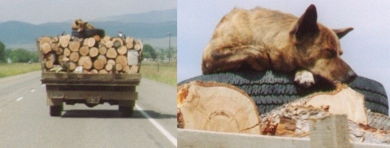
Just north of Helena we came across this. It has nothing specifically to
do with Montana but we found it to be interesting. There is a closeup
on the right where you can clearly see that despite being on a spare tire
on top of a pile of logs in a truck augmented with wood railings traveling
at 55 mph (88 kmh), the dog is perfectly relaxed.
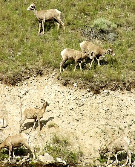
Our next stop was Gates of the Mountains about 15 miles (25 km) north of Helena.
This is a wilderness area along a canyon the Missouri river has carved into the
surrounding hills. The wilderness area itself is crossed by difficult to reach
hiking trails which are extremely challenging (in the vertical direction). The
easiest way to view the canyon is from a boat. Tours leave from just upstream of
the canyon on a regular basis. This family (we're assuming they're related) of
bighorn sheep came down to the river to drink as we passed by.

For people with their own boats, there are several river-accessible campsites
and day-use picnic areas where the shoreline is flat enough to support it.
There aren't many places where that happens but this is one of them. The
current is fairly strong here but there is no whitewater as the Missouri has
long since been peppered with dams.

Among the wildlife common here are bald eagles, osprey and the common
merganser duck. We point this out because our tour boat guide pointed them
out. Every single one. There are quite a lot of common merganser ducks
on this stretch of river (hence the word 'common'). Overall though this is
a nice relaxing off the main path sort of tour. If you arrive earlier in the
day than we did, you can take a boat to the picnic area and hike from there,
returning on a later boat.
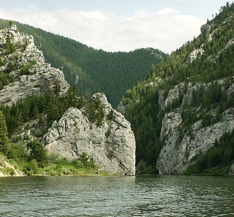
Lewis and Clark did come here. Or at least Lewis did. He saw this opening
(which probably had whitewater at the time as well) and declared in his
journal that he would call this place 'Gates of the Mountains'. He did, and
now everyone else does too.

Butte, Montana is also an unusual city. We may be wearing that moniker
out on this page but notice the enormous open-pit copper mine on the right
side of this picture. Yes, Butte is a city built overlooking a pit mine.
It's sort of fascinating at first although the stories of just how toxic
the water in the mine is become rather alarming after a while. Unsurpisingly,
Butte has a higher than average number of 'copper' gift stores. If you're
looking for something a little different and made out of copper, this might
be the place for you. For us, it was just a place to stop at K-mart and buy
more supplies before several days of camping. Also we have to put in a good
word for dinner that night. We headed up the Big Hole river valley (southwest
of Butte) towards the Idaho border. The area mostly caters to fly fishermen.
Well up the valley you'll find the town of Wisdom. We're not clear on the restuarant
name, it is something like 'Big Hole Crossing' but we think it's the only
place in town anyway. So basically, if you ever find yourself in hungry in Wisdom,
you don't really have a choice, but that's okay because this place is good anyway.
Now we jump several days forward to the ending portion of our trip and our
return to the fine state of Montana. If you're a stickler on chronological
order, you should go read the Idaho / Teton / Yellowstone pages and then
come back to this point.
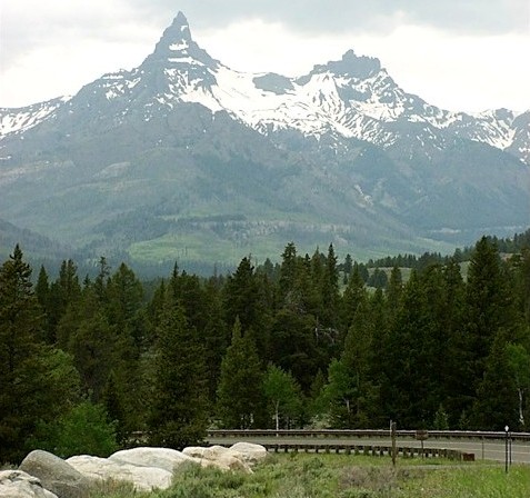
The so-called northeast entrance (or exit) to Yellowstone Park connects
to the rather spectacular Beartooth Highway. The scenery along this road is
incredible as it winds through the Beartooth and Absaroka mountain ranges.
The road meets Yellowstone in Montana but dips into Wyoming for a few miles
before curving back into Montana.

The Wyoming side is Shoshone National Forest where the road crosses Crazy
Creek. There's a campground (Crazy Creek campground) on the south side of
the road and a trail head on the north. A short hike up the trail will
bring you to this impressive cascade, although admittedly this was at fairly
high water levels. There are grizzly bear warnings everywhere through this
area although we personally did not see any.
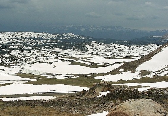
The Beartooth Highway tops out at a whopping 10,900 ft (3300m). The south
approach winds slowly up through a series of plateaus, most of which have
scenic small lakes on them. Notice the amount of snow still hanging around
in late June. The north approach is more of a steep-as-possible series of
switchbacks up the side of the mountain. This is a good place to see marmots
as well, in fact, it's pretty much overrun with marmots.
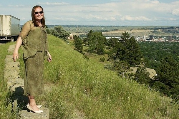
We can dress Melanie up for a wedding but she still ends up climbing on
rocks. The ostensible reason for this trip was the wedding of Melanie's
friend Kirsten which took place here in Billings. That's Billings out
in the distance. The cliff which runs around two sides of the city is
known as the rimrock.