We'll start this off with a disclaimer: due to a small camera incident,
our pictures of Seattle were somewhat mangled. These three have survived
more or less but the resolution has suffered greatly.
Anyway, we begin with a picture of some fish on ice in Seattle's Pike Place
Market. Our first stop because it was not only in the middle of town, it was
a fine place to go when hungry. We were hungry because even 2 airline breakfasts
do not adequately suffice to cover 7 hours of flying. Pike Place Market is
typically known for the fish markets were employees fling the wares back and forth
across the counter. This is really not very interesting although many people
spend hours videotaping it. Furthermore, since no one is buying fish (how many
tourists do you know who buy fresh whole salmon while travelling?) they eventually
start fish-flinging for entertainment purposes only.
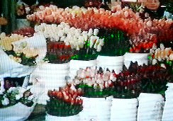
Fruit, vegetables and flowers are also common at the market including the
seasonal tulips shown here. Other sections have flea-market stalls and
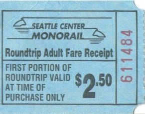
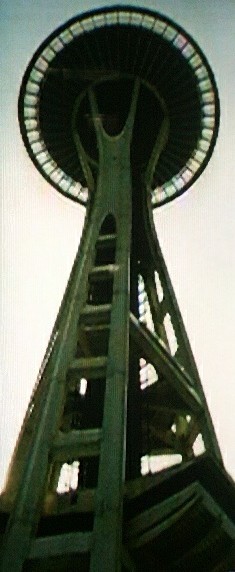
more permanent stores. We took the monorail (billed as the world's first) from
downtown to Seattle Center, home of the space needle, and the ridiculously
shaped building which is home to the Experience Music Project (that picture
was sadly lost). At Seattle Center we found that there really wasn't a whole lot
to do unless you wanted to pay $11 to go up in the Space Needle. It wasn't
a particularly clear day and we didn't want to do this so we decided to roam
areas outside of downtown instead.
Our advice is this: Don't pay $11 to go up in the Space Needle unless you
really have nothing better to do and $11 to waste. Instead, drive up into the
Capitol Hill section of town just east of Downtown and go to Volunteer Park.
There you'll find a brick cylindrical structure which is actually a water tower
dating from the beginning of the 20th century. You'll find you can climb up
to the top of the water tower for $0 although there is admittedly no elevator.
At about 100 feet (30 meters) it's a good solid 500 feet (150 m.) shorter than
the Space Needle, but it sits on a nice hill and thus has a higher overall
altitude and provides a fine view of Seattle, the Puget Sound, and Lake Washington
and the Cascades.
Later in the evening we returned to Seattle to find that on a Thursday at least,
there isn't a whole lot to do in Pioneer Square (the historic district) or downtown
in general. There are several nice microbreweries but unfortunately they stopped
serving food before we arrived around 9:00 PM.
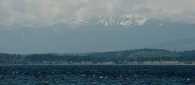
The next day we took a short and uneventful ferry ride to the south end of
Whidby Island and began wandering along both coasts towards the north end.
This picture was taken from an unspecified beach looking across Puget Sound
to the Olympic Mountains in the distance.
At the north end of Whidby Island and the south end of Fidalgo island is
Deception Pass State Park. The adventurous sounding name comes from a remarkably
dull story. In a nutshell, the explorer (George Vancouver) believed Whidby Island
to be a peninsula. Just imagine his shame at the local explorer's club when it
turned out to be an island. He named the pass 'deception' so people like us,
hundreds of years later, could share in the geographical faux pas. Regardless,
it's an impressive pass with high cliffs on either side and some nice hiking
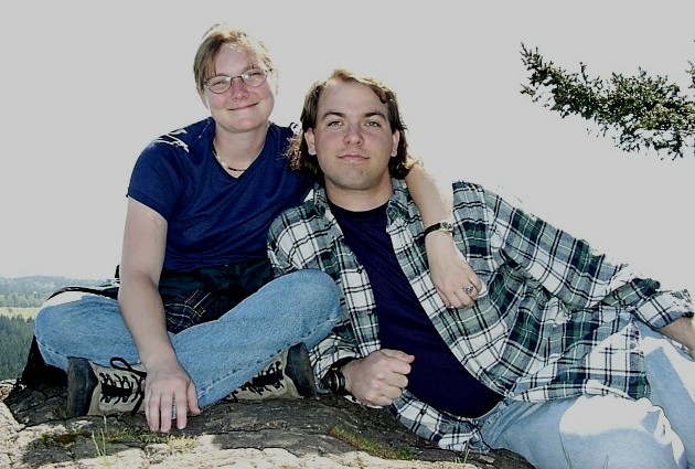
trails. This picture of us atop a hill was intended to show off Whidby
Island and the Olympic Mountains in the background but we failed. To commemorate
our own miscalculation we offer to christen this 'overexposure hill'.
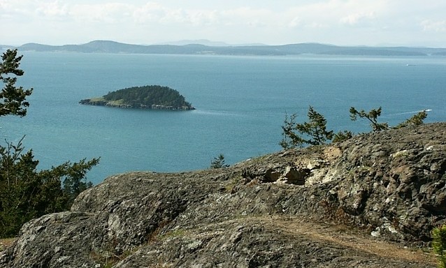
Here's a better view of the scenery without us in the way. Those are varied
and sundry of the San Juan Islands out there in the sound. The park is known
for a variety of sea mammals which can be seen from its shores. We saw nothing
more interesting than some pale blue butterflies. 'Lack of visible sea mammals'
would in fact become a pretty good alternate title for this whole trip.
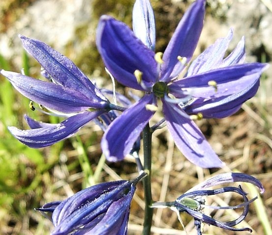
A decent variety of wildflowers covered the area including a large number
of Camas Lilies like this one. There are a total of 38 miles (61 km) of
hiking trails in the park although they're tightly wound about either side
of the pass. There are also several rocky beaches which are apparently
quite popular in the summer. We continued on north of the pass and turned
inland towards the Skagit river valley.
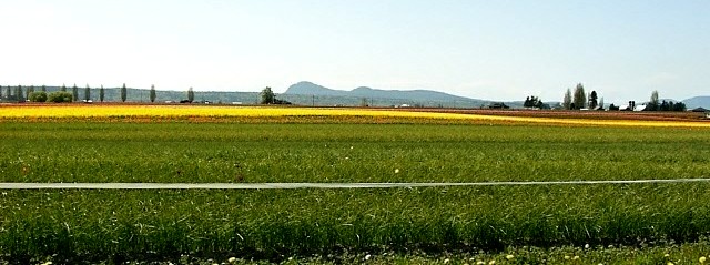
The Skagit Valley area holds its tulip festival every April. The tulip
fields are impressive while in bloom. The view from the road is of fields
with wide swaths of multiple bright colors. Up close, you'll find that many
farms actually charge people a couple dollars to walk amongst the tulips.
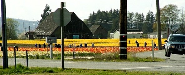
The tulip festival, which is co-hosted by several area towns, features several
dozen events which for the most part have nothing whatsoever to do with tulips.
Our favorites from the brochure were the daily llama-shearing (weather-permitting)
and the 'Art in a Pickle Barn'. We did not stop to wander in any of the fields,
but the traffic was so thick that we spent plenty of time stopped along the road
to take these pictures and see some of the flowers close-up. If you happen to
have a tulip fetish of some sort you could definatly spend a few days in the area.
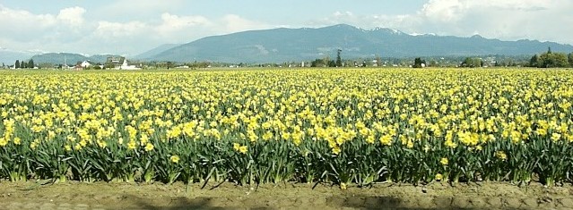
Daffodils are equally popular in terms of agriculture although they receive
lower billing in the festival. Fields like this one stretch pretty much from
the Cascade Mountains to the shoreline. The town of LaConner holds an associated
street festival (as do several other towns in the valley) which is your pretty
typical small town festival with the possible exception of tulip jelly for sale.
We headed north for the Canadian border after an hour or so of tulip exposure.