Arenal
There are several choices available for driving from San Jose to the area around the
Arenal Volcano. We chose to take the La Fortuna route (which goes through the town
of La Fortuna). Our first side trip was to the artesan's village of Sarchi. Possibly
Costa Rica's best known tourist trap. Sarchi is primarily a woodworking center and
from what we saw of the hand-crafted furniture for sale in the area, it did appear
to be very high quality. Rocking chairs are a little tough to take home on the plane though
so we settled for a few souvenir items and left. Sometimes when travelling you come
across those thoroughly unexpected places that really do make the 'getting there' part
of the adventure. Zarcero is one of those places. High above the central valley after
more than hour of driving through thick fog, we found ourselves here.

Every Costa Rican town, village, and city we visited had certain characteristics
in common. There is invariably a central park. Facing the park will be the town's
cathedral, and likely the post office. Just down the road will be the school and
somewhere nearby will be the soccer field. After that individuality can be added.
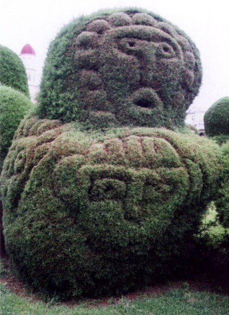
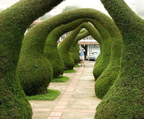
Zarcero's variation on the theme takes place in the central park which has become
an elaborate topiary garden. There's no particular motif here just the whims of the
one man who's responsible for it all.
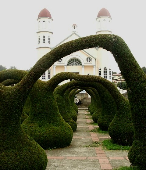
Here is the promised cathedral at one end of the park. In Zarcero the school is next door
and was in recess during our visit so the park was filled with children. Many more could
be heard than seen given the complexities of the foliage. It all has a certain Dr. Seuss
quality to it. We spent a little while wandering through it before continuing on to Arenal.
Zarcero is about at the peak of the road over the central mountains. Continuing to the
north the road drops into a huge flat valley which leads up to the very base of Arenal.
Once in the valley it's an easy drive but crossing the mountains is not. Visibility was
poor on the day we travelled and locals told us that was not unusual. The road itself
was not in bad condition but trucks barrelling around the narrow turns can be somewhat
harrowing. It wasn't until we were nearly to Arenal that we came across the most feared
road sign in Costa Rica: Carretara en mal estado (road in bad shape). These signs are
to be taken seriously. In some cases the following day we had problems finding the road
as it often deteriorated to a series of rocky ridges or was washed out by an impromptu
creek. Despite all that most roads are not as bad as one might be led to believe.
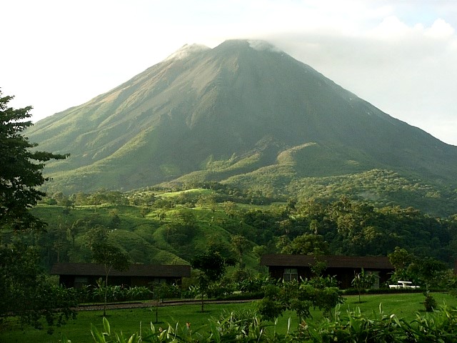
Arriving in the vicinity of Arenal we found the Volcano itself to be shrouded in clouds.
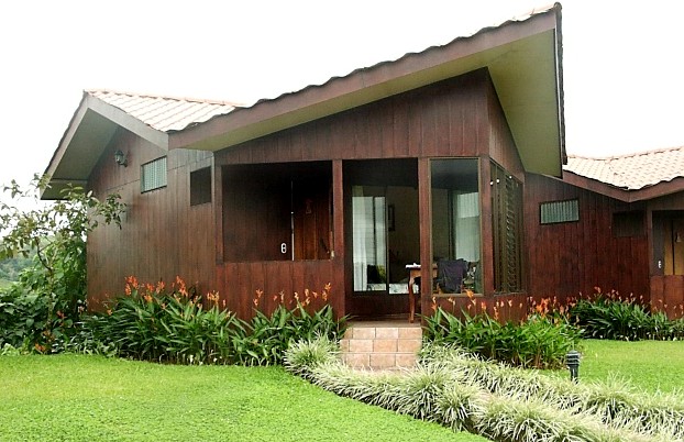
We chose as our base the hotel Montana del Fuego which consists of a line of small
cottage-rooms. It also has a spa, restaurant and a spring-fed hot tub. This picture is
of our room there. Expensive during the tourist season, Arenal's lodges are much more
reasonable during the rainy season with the possible exception of the well-known Tabacon
resort just down the road. Of course the most fascinating aspect of the hotel is the
view from our front porch.
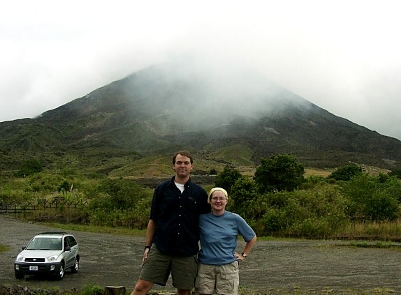
It looked about like this. To be fair, this picture was taken at 5:30 AM the next
morning when we got lucky and the surrounding clouds disappeared for a little while.
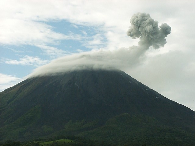
Of course, even with the clouds it's an impressive thing. Within a few minutes of arriving
at our hotel we could hear activity from the volcano. Arenal is one of the most active
volcanoes in the world and erupts as often as three times a day. Noises from the volcano
are classified as 'chugs', 'whooshes' and 'booms'. We went first to the National Park
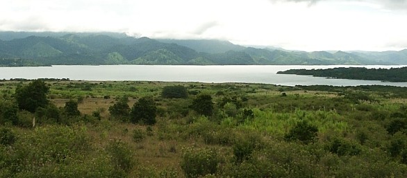
entrance (on the west side of the volcano) and the viewpoint there. This is Lake Arenal
at the base of the western slopes of the mountain. The hills on the left lead up towards
the cloud forest of Monteverde which is geographically close but not logistically close
at all.
Although Arenal National Park covers the entire mountain, most of it is off-limits.
Some guided tours into the restricted areas are available but this has resulted in
a few deaths over the past few years. This viewpoint is easily accessible from
the entrance and hiking trails run around the perimeter of the mountain.
A popular short hike is to the lava flow from Arenal's massive eruption in 1992.
The trail mostly traverses a semi-barren landscape covered in tall grasses and lichens.
We saw snakes, lizards and birds but nothing larger. Close to the 1992 lava flow
the trail dips down into a remarkably fertile valley, pictured here. This section
is indistinguishable from other rain forest areas of Costa Rica despite its location
and small size. The volcano was quietly chugging away during our hike with the
occassional 'woosh' thrown in for good measure. Chugs sound rather like a very distant
'pop'. Wooshes sound like an airplane flying low overhead.
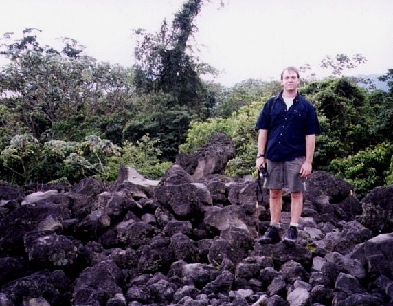
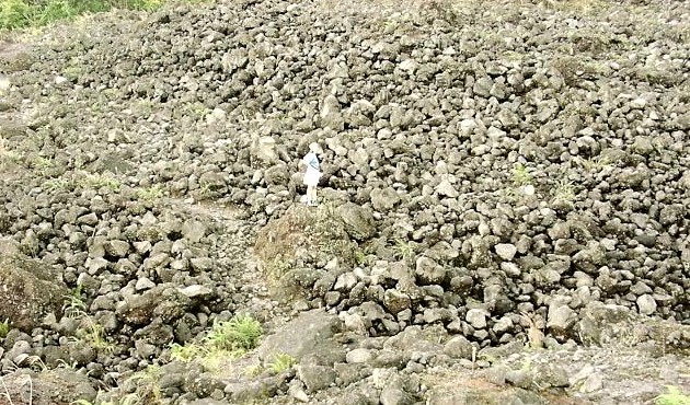
The lava flow appears suddenly where the low-lying jungle section ends. Oddly enough
not many people seem to come here although it's quiet an impressive site. The jumbled
pile of igneous rocks stretches from the upper slopes of the volcano almost to the shore
of the lake. If you're wondering what most people who aren't hiking here are doing instead,
our experience was that most of them were basking in the thermal waters at Tabacon Hot
Springs. We did not visit Tabacon but it was obvious even just from driving by that it
was quite popular.
That is Melanie surveying the scene in the center of this picture. We've mentioned
the chugs and whooshes. The booms probably don't require much in the way of explanation.
We experienced our first one within seconds after this picture was taken. The ground
shook and it felt like the air around us was vibrating. In retrospect it was a fairly
normal, daily eruption. This being our first experience with an active volcano, we
found it quite alarming and quickly began the return hike to the car.
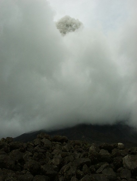
The top of the mountain was still shrouded in clouds but that didn't prevent us
from seeing the tangible results of that eruption. The ash cloud (top center)
was clearly visible rising above the mountain. The locals seem rather at ease
with Arenal as a neighbor but we found most of the tremors and louder noises to
at least be worth a hasty glance in the direction of the mountain. As night fell
we hoped to be able to see the lava (invisible during the day) glowing on the upper
reaches. From our hotel we could see a few red spark-like flashes every so often.
Curious, we drove back to a little gravel parking lot near a 'tourist police station'
by the entrance to the national park. This was one of the closest vistas of the
entire northern flank of the mountain. We stood in the dark being eaten by various
tropical insects for some time listening to strange volcanic noises but seeing
nothing. Finally our patience was rewarded with a spectacular eruption. A glowing
orange fountain of lava shot out of the top of the mountain and slowly cascaded back
down before becoming too faint to be visible. We have no picures of this as we were
both standing awestruck watching it.
As already mentioned, the view was awesomely clear at 5:30 AM the next morning. By
6:30, after an hour of watching it we had both fallen asleep again. The third
eruption during our stay came at about 7:05 AM. We must say it's amazing how quickly
you can react from a sleeping position when a volcano erupts two miles away. This was
the scene outside just seconds later. We left Arenal a couple hours later quite
satisfied that we had at least seen some action from the Volcano. We headed along
the north shore of Lake Arenal planning to circle it towards the Monteverde Cloud Forest.
Our guide books mentioned this road as "spectacularly bad".
That isn't really true. The spectacularly bad roads are those leading up to the
town of Santa Elena and the Monteverde Cloud Forest. Another popular tourist site
in season (ok, so we didn't exactly go too far off the beaten path), Monteverde
is most popular among bird watchers.
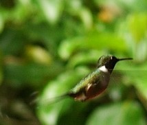
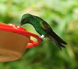
The visitor center area of the national park is absolutely filled with hummingbirds
like the two shown here. Costa Rica's brightly colored national bird (the resplendant
quetzal) is the featured target for bird-watchers. These poor hummingbirds were
subjected to an onslaught of massive telephoto lenses set up in the area. We actually
didn't see any of the birdwatchers on the hiking trails though, perhaps because their
camera equipment is too heavy to lug around.
Besides the National Park, there is a more relaxed version of the Canopy Tour nearby,
plus an aerial tram, a network of suspended bridges and a slew of horseback tours. We
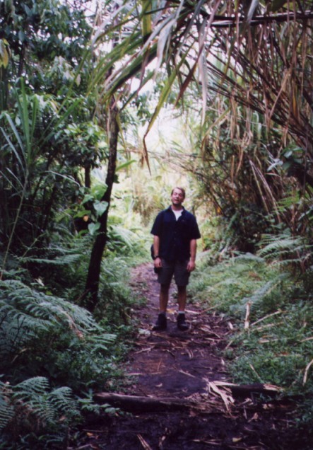
stayed on foot, mostly on smaller, less-used trails hoping to see more wildlife. We
were encouraged by the sign at the visitor center which said "Please do not feed the
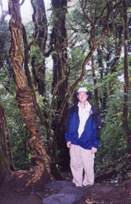
coati". We have no idea what kind of tree this is next to David but it's pretty neat.
Despite our best efforts, we did not see any particularly exciting wildlife although
we're convinced there must have been slothes up in the canopy above us somewhere. We
found quite a few interesting birds (no quetzals), a vast number of mosquitoes, and
a few rodents of some type. One of these, which appeared to be a common squirrel, was
busy carrying a guava around.
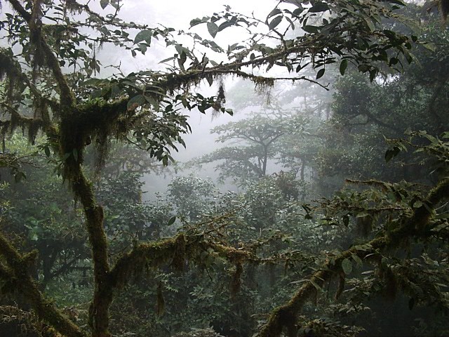
The foliage was dense and wherever the mountain dropped off was a layer of thick clouds.
They do call it a cloud forest for a good reason. Most of the clouds come in from the
Pacific Ocean, drop a tremendous amount of rain on Monteverde, and then continue on
passively towards the Caribbean. There was quite a bit of background noise here as well,
the combination of birds, insects, rushing water, and the wind above the canopy. The
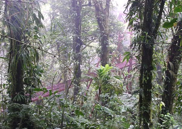
newest hiking trail (at the time of our visit) features this magnificent suspension
bridge across a sizeable gorge.
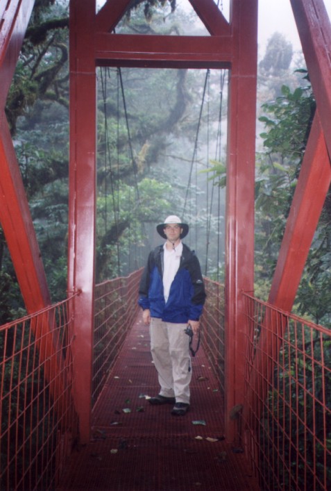
Built to provide access to the canopy, one thing it definately does allow
closer inspection of is some of the hundreds of species of orchids which
can be found here. We found a few orchids easily visible from the trail
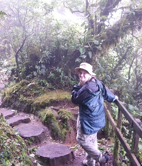
but many of them were high above in the treetops. Here David models some
of the necessities of a visit to Monteverde - a rain hat, rain jacket, and
boots. Monteverde receives more than 3m (10ft) of rain each year! We highly
recommend a good bug repellent as well. It's recommended everywhere in rural
Costa Rica but we found Monteverde to be particularly bad.
On our way down to the Pacific Coast and the Inter-American Highway from
Monteverde, we gave a ride to a local woman who was taking coffee (as in,
a huge burlap bag of freshly-picked coffee) back to her village. We were
glad to have her along as her son told us (more or less, our Spanish isn't
all that good) that the road ahead was underwater due to an impromptu river.
This is actually not uncommon during the wet season but it did save us a bit
of time. Of all the conflicting but invariably dismal reports we had heard
on Costa Rican roads, Monteverde was really the only area that lived up to its
billing. The InterAmericana back to San Jose was well paved but more infuriating
to drive as Costa Rica doesn't seem to have invented the climbing lane for trucks
as yet. For this trip we actually modified our plans to avoid driving in certain
parts of the country, something we won't do on our next trip there. Unless
you're a very squeamish driver go ahead and rent a car (4WD), just drive cautiously,
allow lots of time and watch out for livestock.