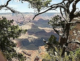
We arrived at the Grand Canyon close to midnight and after checking into our hotel (and
finding it) we immediately set out to walk over to the rim. It was nearly a full moon but
that didn't help reveal much. Fog rising up from the Colorado River obscured the lower
half and the north rim wasn't visible at all. So basically we just had the impression of
a vast open space out in front of us. Still, there was no one else around and it was a
good first impression.
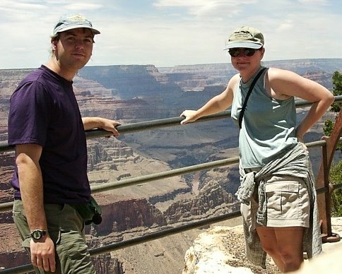
The following morning we returned to the south rim and found it quite a bit more active.
Actually, it was nearly impossible to get near the railing to see into the canyon. We
only had about half the day to see what we could, so we set out along the south rim trail
which is serviced at various points by a tram system.

The Colorado river itself was difficult to see along most of the rim although on the road
east towards the little Colorado River canyon there are some good views of it and some of
the rapids such as this one.
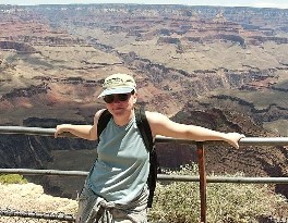
For the first mile or two the rim trail is relatively crowded. There are quite a few
shuttle bus stops and the path is paved with safety railings along most of it.
After two or three miles there are no tram stops and thus fewer people. From several
vantage points we could see the Bright Angel Trail descending into the canyon which was
incredibly crowded despite the large number of warnings against taking it lightly. Among
the interesting facts we learned - an average of five people per year die from falling at
the canyon, but the number one cause of death is drowning (in the Colorado River).

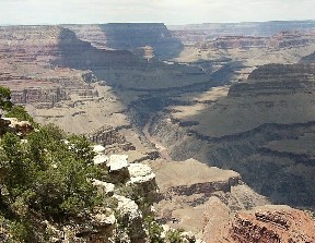
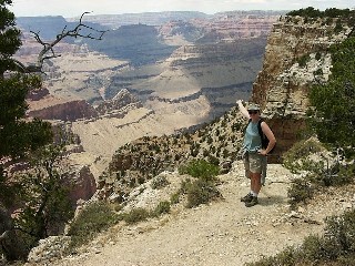
Once the path becomes a narrow dirt trail with no railings it becomes more interesting. It
also allows for much more dramatic pictures like this one and the following one where you
may not realize how close to the edge you were standing until after you see the picture.
We took the tram back to the village and left the national park after that. There are
quite a few good vantage points along the road to Cameron, Arizona as well as some truly
difficult descending trails that we intend to come back and pursue at a later date.
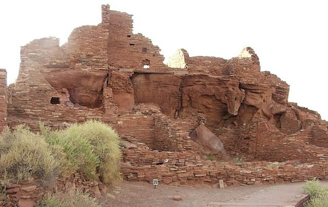
Wupatki National Monument is just a little southeast of the Grand Canyon and contains the
remains of several dozen Anasazi settlements. Scattered across several ridges and amongst
juniper and pinon trees several of the larger ruins can be visited. This is the largest,
Wupatki, located behind the visitor center. If you look carefully you'll notice that
amongst the bricks is an outcropping of natural red sandstone which was used as the
foundation of this building. Several families lived here in suprisingly small quarters.
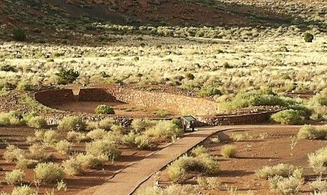
Also nearby are the remains of a ball court where games similar to those played by the
Mayans were held. The exact purpose of the games is not known, though unlike the Mayans
the Anasazi did not kill the losers.
At the time that Wupatki was thriving (1200-1400 AD) and the settlements in Canyon de
Chelley were thriving, nearby Sunset Crater was volcanically active. In fact significant
eruptions in the 12th century led to fertile soil north and east of the volcano which in
turn led to all the Anasazi settlements in the area. Today the main crater is surrounded
by a thousand foot high cinder cone and there has been no recorded activity in recent
centuries. Sunset Crater National Monument is adjacent to Wupatki.
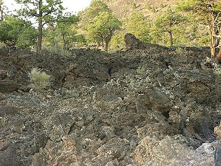
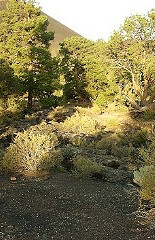
There is a rather interesting trail on one side of the cinder cone, especially if one
isn't very accustomed to volcanic landscape (and we aren't). This chaotic jumble is an
ancient lava flow. The ground around the volcano is finely ground black rock with a
sand-like consistency.
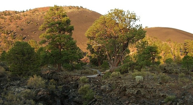
The name of Sunset Crater came from the reddish hue that the cone takes on during
particularly good sunsets. This, according to a local photographer who showed up, was not
a particularly good sunset although it was certainly still impressive.


 We arrived at the Grand Canyon close to midnight and after checking into our hotel (and
finding it) we immediately set out to walk over to the rim. It was nearly a full moon but
that didn't help reveal much. Fog rising up from the Colorado River obscured the lower
half and the north rim wasn't visible at all. So basically we just had the impression of
a vast open space out in front of us. Still, there was no one else around and it was a
good first impression.
 The following morning we returned to the south rim and found it quite a bit more active.
Actually, it was nearly impossible to get near the railing to see into the canyon. We
only had about half the day to see what we could, so we set out along the south rim trail
which is serviced at various points by a tram system.
 The Colorado river itself was difficult to see along most of the rim although on the road
east towards the little Colorado River canyon there are some good views of it and some of
the rapids such as this one.
 For the first mile or two the rim trail is relatively crowded. There are quite a few
shuttle bus stops and the path is paved with safety railings along most of it.
 After two or three miles there are no tram stops and thus fewer people. From several
vantage points we could see the Bright Angel Trail descending into the canyon which was
incredibly crowded despite the large number of warnings against taking it lightly. Among
the interesting facts we learned - an average of five people per year die from falling at
the canyon, but the number one cause of death is drowning (in the Colorado River).
 Once the path becomes a narrow dirt trail with no railings it becomes more interesting. It
also allows for much more dramatic pictures like this one and the following one where you
may not realize how close to the edge you were standing until after you see the picture.
 We took the tram back to the village and left the national park after that. There are
quite a few good vantage points along the road to Cameron, Arizona as well as some truly
difficult descending trails that we intend to come back and pursue at a later date.
 Wupatki National Monument is just a little southeast of the Grand Canyon and contains the
remains of several dozen Anasazi settlements. Scattered across several ridges and amongst
juniper and pinon trees several of the larger ruins can be visited. This is the largest,
Wupatki, located behind the visitor center. If you look carefully you'll notice that
amongst the bricks is an outcropping of natural red sandstone which was used as the
foundation of this building. Several families lived here in suprisingly small quarters.
 Also nearby are the remains of a ball court where games similar to those played by the
Mayans were held. The exact purpose of the games is not known, though unlike the Mayans
the Anasazi did not kill the losers.
 At the time that Wupatki was thriving (1200-1400 AD) and the settlements in Canyon de
Chelley were thriving, nearby Sunset Crater was volcanically active. In fact significant
eruptions in the 12th century led to fertile soil north and east of the volcano which in
turn led to all the Anasazi settlements in the area. Today the main crater is surrounded
by a thousand foot high cinder cone and there has been no recorded activity in recent
centuries. Sunset Crater National Monument is adjacent to Wupatki.
 There is a rather interesting trail on one side of the cinder cone, especially if one
isn't very accustomed to volcanic landscape (and we aren't). This chaotic jumble is an
ancient lava flow. The ground around the volcano is finely ground black rock with a
sand-like consistency.
 The name of Sunset Crater came from the reddish hue that the cone takes on during
particularly good sunsets. This, according to a local photographer who showed up, was not
a particularly good sunset although it was certainly still impressive.