Upper Peninsula
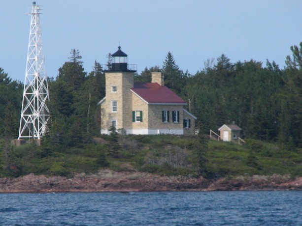
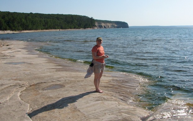
While we covered pretty much the entire east-west expanse of the U.P., our pictures are highly concentrated around the photogenic Pictured Rocks region. As such the text will mostly, but not entirely, be matched with the images. We entered the U.P. from Wisconsin at the town of Ironwood. We're not sure if the U.P. has an official food, but if they did, it would be the pasty. The Ironwood area which includes a collection of mining-based communities seems to have more pasty shops per capita than anyplace else we visited. Pasties derive from their Cornish ancestors and realistically aren't all that exciting. Meat, potatoes, maybe some seasoning if you're lucky. They're easy to eat while driving though and something a little bit different from the usual road food. The picture here is of the harbor light in Copper Harbor.
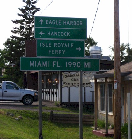
Copper Harbor is a small community on the tip of the Keweenaw peninsula. Rumor has it that it's about 1990 miles from Miami. The Keweenaw has several interesting old mining towns (like Calumet) and a few beachfront villages that survive mainly on tourism. It's the kind of place where the local police have to come out and chase everyone off the main road when a house (on a trailer) is approaching from the other direction. We know this because it happened to us. It's really totally irrelevant but it did take us a few minutes to figure out what might be happening after the policeman told us in the quirky UP accent "in a few minutes, thill be a hoess comin' dun the rood." He was right, a hoess did come down the road.
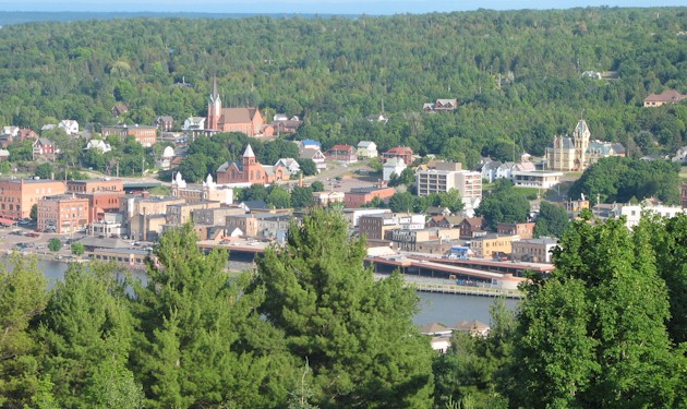
This is the picturesque town of Houghton, as seen from the opposing town of Hancock. A key transportation note here is that the elevator bridge downtown is the only connection between the Keweenaw peninsula and the rest of upper Michigan. This means that if you're staying in Hancock (which we were) and you're having a beer at The Library in Houghton (which we were) and the bridge breaks down (which it did), you might as well hang out for a while and have another one.
South of the Huron Mountains, near Ishpeming and Marquette, we have a serious dearth of pictures. We can tell you there are a ridiculous number of deer. They like to wander onto the road and they're particularly stubborn about getting off the road. If you're driving through Marquette, try to avoid timing it right as the Tour of Superior road bike race goes through. We failed to do this, despite wondering why everyone else in our hotel was wandering around in spandex shorts with a number pinned to their chest.
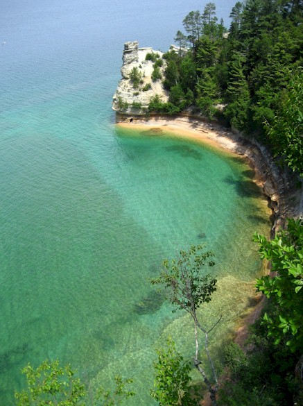
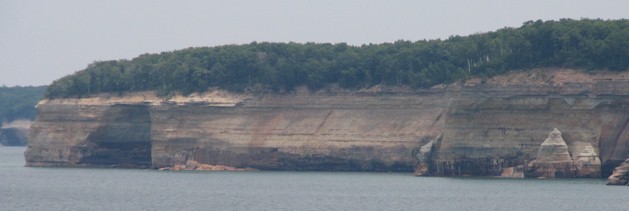
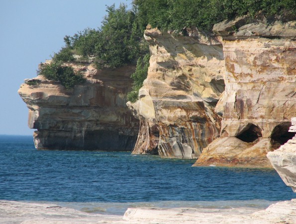
This is Pictured Rocks 101. You drive a few miles out of the town of Munising and take this picture of Miner's Castle. It's slightly less Castle-y than it was a few years ago before a rock slide removed part of it. You admire the brilliant blue-green water along the shore. You visit a couple nearby waterfalls and then you take a two-hour boat ride along the shoreline and look at the cliffs. There's nothing wrong with doing any of this, but the unpaved roads that traverse deeper into Pictured Rocks National Lakeshore seem to deter a lot of people from going any further.
The Mosquito and Chapel areas for instance are both quite nice. But before we get there, let's stop in Van Meer. Van Meer is the 'town' where the pavement ends, or rather it turns south. The only commercial establishment here is the Bear Trap. The Bear Trap is a snowmobiling themed bar and restaurant and it's the last place to get a decent meal until Grand Marais, so stop by and have a Wisconsin Burger (made from bratwurst).
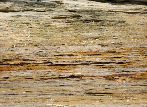
And now a brief educational interlude: The cliffs at Pictured Rocks represent thousands of years of compressed sediment. The Lake Superior basin has supported a lake for a very long time. Mountains (real big ones) in Minnesota and the area which is now the Upper Peninsula eroded off into the lake and ended up in layers like these. The reddish color comes from iron rich water that seeps through the rock. Similar bluish-green stains in some of the other pictures are from copper. For the most part this stuff erodes very nicely from waves and caves are quite common.
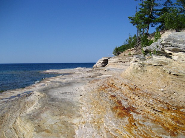
Here's some caves now. This is Mosquito Beach. There were not a whole lot of mosquitoes on the beach when we were here but there were plenty of stable flies and frankly we'll take mosquitoes any day. Mosquitoes at least respect some repellents. Stable flies are annoyingly persistent and we abandoned at least one potential campsite due to swarms of them. The 'beach' here at Mosquito Beach is actually layers of ridged rock. It's approximately a 2 mile (3.2 km) hike down to Mosquito Beach and it would be a lovely secluded place to camp and spend the day, except tour boats out of Munising go cruising past every hour or so.
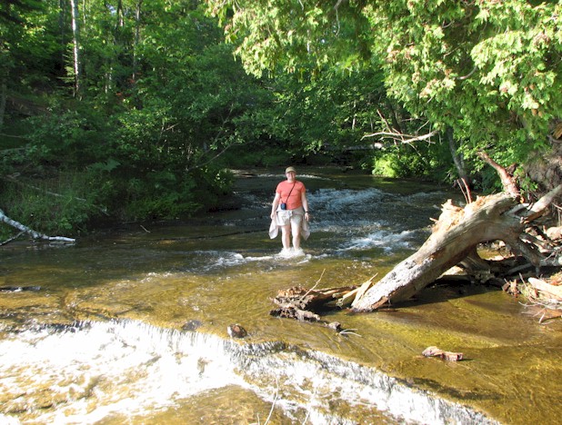
The Mosquito River flows into Lake Superior, rather uneventfully spreading out across the beach. There are campsites just a little ways upstream and trails heading south towards the road on both sides of the river.
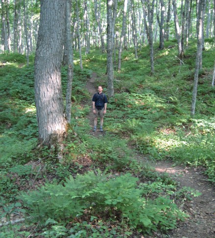
The mix of hardwood trees and very low undergrowth (mostly ferns) allows for great visibility when hiking around Pictured Rocks. This in turn is good for spotting wildlife from some distance off. Theoretically, if there were a moose anywhere in the vicinity (in the middle of the day) we'd have been able to see it.
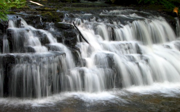
There are a lot of waterfalls in Pictured Rocks and in the Upper Peninsula in general. Hiawatha National Forest features several that are relatively unvisited compared to the handful of popular ones around Munising. This is Mosquito Falls which is one of the more accessible in terms of viewing opportunities.
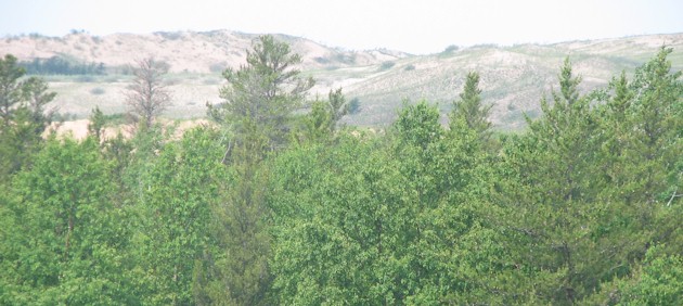
As you approach the town of Grand Marais the landscape shifts suddenly and huge sand dunes appear between the road and the lake. This area is called Grand Sable Dunes and it looks approximately like this from a distance.
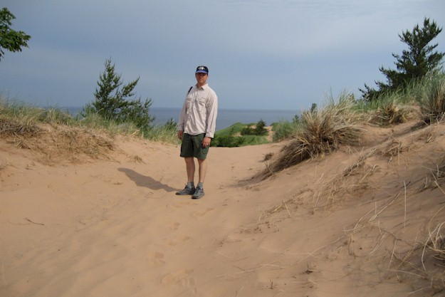
Dunes have very fragile ecosystems and thus access to the area is limited. There are a couple of trails that just extend into the edges of the dunes. The sand here is incredibly fine and hiking in it is challenging.
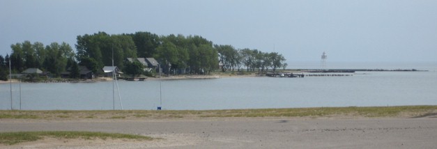
The tiny harbor community of Grand Marais is located on the far eastern end of the national lakeshore. There's a good general store for supplies if you're camping at any of the nearby campgrounds. Just as important, Lake Superior Brewing Company is located here. We didn't eat at their small restaurant but we did take a growler of beer back to our campsite with us. From Grand Marias heading east there is an interesting network of forest roads in varying states of repair. If you're headed towards Tahquamenon, it's worth experimenting. Most of the roads generally funnel you in that direction and the area around the Two-Hearted river is particularly scenic (and moose-free).
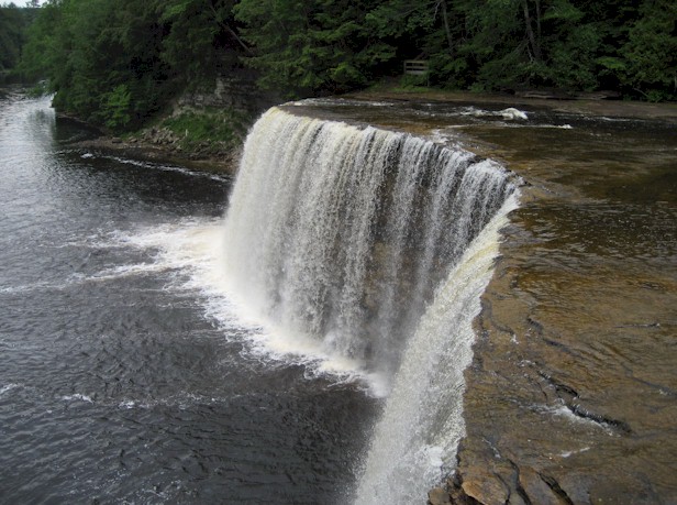
Tahquamenon Falls (there are actually at least three of them) are back on the paved roads and near the main route across the peninsula. Coming from a couple days on the back roads of Hiawatha National Forest, Tahquamenon was a bit of a shock with the souvenir stores everywhere, vast parking lots for tour buses, ice cream stands and so on. However, we're willing to forgive this as Tahquamenon is the only state park we've ever visited that features a brewery on the premises. To be honest, by UP brewing standards (which are quite high) this wouldn't make our list of the best breweries in the area. As on-site microbreweries at tourist attractions go, we give it high marks.