Jasper

The next morning, we went rafting on the Kicking Horse river. Unfortunately
we have no pictures of this but it went smoothly. The other people
on our tour left at the midpoint, and so we had our own private guided
tour on the more challenging lower section of the river. Needless
to say, the water was incredibly cold. After the trip and lunch,
we headed back up the river, this time staying on land. Just leaving
the town of Golden, we came across this small troupe of mountain sheep
crossing the road.

Yoho is a bit more remote than the other parks we visited. The 'town'
at its center is called Field, and is really just a glorified ranger station.
Also, a significant portion of Yoho is occupied by the Burgess Shale Site,
an area that has yielded a lot of dinosaur fossils and is off limits to
the average hiker. The park does contain an impressive set of spiral
railway tunnels, designed to overcome the problem of particularly steep
gradients. It also features one of the highest waterfalls anywhere
- Takkakaw.

This picture is about as close as you could get on this particular day without
getting to thickly into the mist. The falls are 254 meters high (about
800 ft.)
After we left the falls, we drove back across the continental divide into
the northern part of Banff National Park.

There we visited Lake Louise where we took this picture of the lake. Most
likely, besides appearing on zillions of postcards, every other visitor
to Lake Louise has this photograph as well. We decided not to rent
a canoe here, or really spend much time at all as it was the single most
crowded location we visited in the Canadian Rockies.

After we left the lake, we went to a nearby campground to spend the night.
We also discovered a new and exciting salad dressing (three cheese) which
promptly became our official universal condiment for anything that can
be cooked on a campfire.

The next day, we headed north, our first stop being Peyto Lake pictured here.
This particular spot on the parkway through Banff and Jasper is the highest,
above the treeline at about 2100 meters (about 7000 ft.) At the left
edge of the lake you can see water that has run off from glaciers spilling
into the bluer water of the lake and high up on the mountain (upper left)
is another waterfall which winds its way down to the lake.

As impressive as the color is in this picture, it really doesn't do justice
to the lake. It's probably just a color of blue that has to be seen
firsthand.

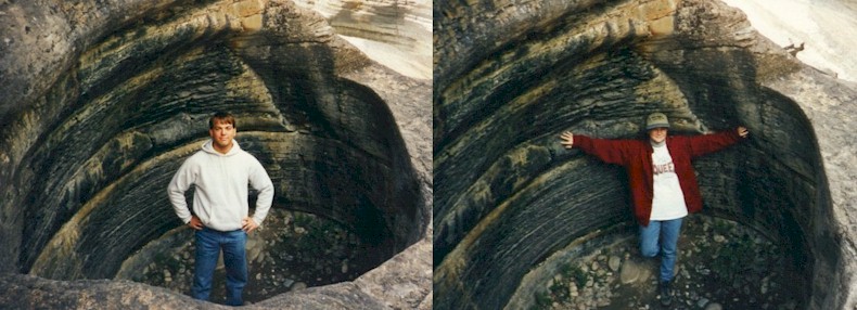
Our next stop was Mistaya Canyon which can be reached by a relatively short
hike. This picture is at the top end of the canyon where the river
drops in. Much of the canyon farther down can not be viewed directly
as the sides become very steep and difficult to reach. There are
no trails along the top of the canyon either so further exploration requires
quite a lot of effort. The entrance to the canyon is remarkable enough
in its own right however. Upstream from here are a series of 'potholes'
formed over the years. Many of these are now back from the
river's edge, although some more recent ones can be seen in the riverbed
as well. These formed in places where the water backed up in
swirling whirlpools that carved through the rock over time. Below,
we each spent a little time getting to know one of them in more detail.

After Mistaya we finally crossed into Jasper National Park. Our first stop
here was at Athabasca glacier. One of the few places where a glacier
comes down far enough to be accessible to those intrepid enough to tromp
about on them. Actually, there are tours higher up the glacier where
large bus-like vehicles on huge tires roll out onto a safe area and people
can get out and wander around. Naturally, we shunned this and chose
the explore-at-your-own-risk route. Notice the crevices around us
here.

This is the view looking up the glacier while standing near its bottom.
This is fairly accurate as to just how bleak it is. To imagine being
there, add frigid temperatures, howling wind, and a lot of semi-frozen
ice/mud muck.

The ice itself is a dull gray color, though the unsullied ice can be seen in
some of the crevices and is a spectacular bright blue. Despite the
fact that the ice has picked up enough silt to darken it, it is still extremely
slippery to walk around on. We recommend taking very very small steps.

This is the very bottom of the glacier. A little of the blue color can
be seen on the left side of this crevice. As we visited in August,
the glacier was currently retreating up the mountainside. In winter,
this spot would presumably be well-buried by the ice, and rocks in the
area were scarred by previous comings and goings of the glacier.
There is also a long-term retreating trend for this particular glacier
which is well documented on the road in.

Next stop was Athabasca falls. One of the more popular, though we were becoming
less enthused by waterfalls having seen so many. (Probably the same way you feel
right about now). This one is impressive nonetheless. One American tourist standing
nearby described this to his family as 'The Niagara Falls of Canada'. Hmmm. We managed
to refrain from comment at the time, so we might as well continue the trend here. After
all, we came across a story of even worse geography knowledge later the same day.

A bridge has been built over the river just downstream from the falls, so
both sides are accessible. The water, as the name implies, is largely
run-off from the Athabasca glacier seen in the previous pictures.

This could be just another glacier picture with our feet cut
off, but it isn't. For one thing, if you look closely to the left
of David's legs, you'll see the tops of several mountains. This picture
was taken atop Whistler's Mountain near the city of Jasper. A tram
ride gets you up to the alpine zone, and a deceptively long trail leads
to the peak from there. At over 8000 ft (2500m) in altitude, it becomes
a difficult hike as well. (At least for us sea-level dwellers).
The camera was carefully balanced on a rock at this point, so you'll have
to excuse the angle.

The clouds coming over the mountain made visibility poor for the most part,
often down to only a few yards at a time. However, when it did clear,
the view across the valley was spectacular as shown here. This is
the city of Jasper as viewed from above. If you magnify this image
intensely, you'll notice just to the lower left of the major 4-way intersection
in the foreground a bit of an anomaly. There was a small single engine
plane that had some problems and was forced to land there on the highway
while we were in Jasper. Apart from that I can tell you that the
top of Whistler's is rocky and uninteresting, though it is supposedly inhabited
by marmots and pikas. That may be true but we recorded zero small mammal sightings
during our visit. On the tram going back down we came across the previously promised story of true
geographical ineptness. A man asked the tram operator
where he was from originally. The tram operator replied, "British Columbia". The man said, "When did you
move to Canada?".

Large mammals we did see, just east of Jasper. These were a bit more wild
than the ones that passed time in downtown Banff (city elk), but this one was nice
enough to pose majestically for us.